Multi-objective Land Use Optimisation for Disaster Risks and Daily Conveniences
The ongoing urban planning necessitates considering both disaster risk and everyday convenience as key objectives. However, certain regions confront trade-offs between these objectives due to factors such as topography and industrial layout. For example, in the aftermath of the Great East Japan Earthquake, some fishermen who traditionally operated close to the coastline relocated to higher ground for safety reasons. This decision, however, came at the cost of enduring long commutes and inconveniences.
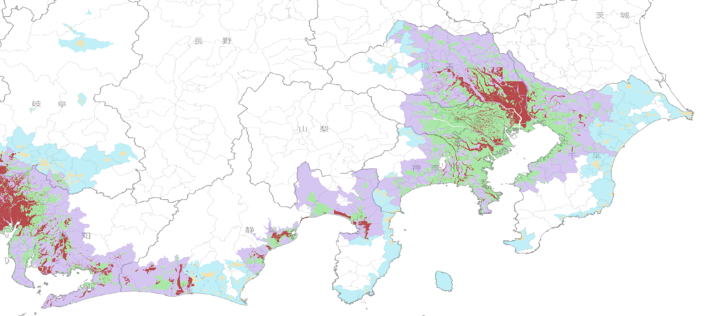
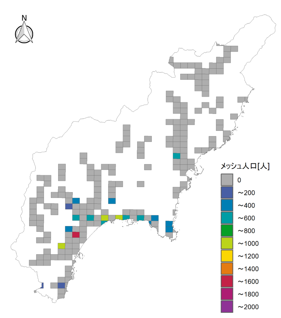
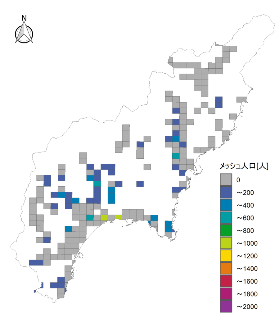
This study has developed an optimal residential area model to analyze the trade-offs between safety from tsunami risk and everyday convenience. The model consists of weighted multicriteria: the total tsunami risk, the total city maintenance cost, and the total commuting time, with controlling allocations of population, land use, and commuting trips. We applied this model to a tsunami-prone coastal area along the Nankai Trough in Japan, conducting calculations for each 500-meter grid. Sensitivity analysis of the weight assigned to each criterion unveiled trade-offs, demonstrating that an increased emphasis on tsunami risk results in higher infrastructure maintenance and commuting costs. We aim to employ this model for conducting applied research in infrastructure investment for disaster reconstruction, addressing conflicts arising from multiple objectives in the future.
Papers related to this topic are available from Nakai et al. (2022) and Uchiuzo et al.(2021).
Tsunami Evacuation Simulation
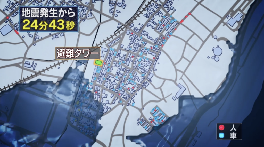
I developed a tsunami evacuation model to simulate how people would evacuate during a tsunami. This model is an agent-based, microscopic traffic model that considers elements such as roads and safe locations for people. We also analyzed how people would move and interact with each other and their surroundings in various situations, allowing us to predict different consequences in different scenarios. To utilize this as a communication tool within coastal communities, we employed a visualization technique that involved overlaying both the tsunami simulation and the evacuation simulation. This helped us gain insights into their temporal and spatial relationships.
Fig1 Tsunami Evacuation Simulation (CG image by Tanista, NHK, and DPRI Kyoto University)
Participatory Modelling and Risk Communication
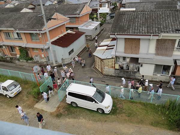
Recognizing the significance of fostering inclusive risk communication, we implemented the tsunami evacuation simulation within the community by employing participatory modelling. In the initial phase, we interviewed residents to inquire about their evacuation plans, including details such as the mode of transportation, destination choices, and other relevant factors. We utilized their intent statements as simulation parameters and assessed the prevailing evacuation challenges as the baseline.
In the subsequent stage, we adjusted the simulation parameters to ensure the survival of all individuals. In the third stage, community residents and our team conducted evacuation drills to evaluate the simulation’s validity and feasibility. Additionally, we made model-setting modifications based on the additional concerns expressed by the residents.
This approach encourages community engagement in tsunami evacuation planning and assessment, traditionally regarded as the government’s responsibility.
Papers related to this topic are available Nakai et al. (2015), Hatayama et al. (2014), and Sun, Nakai et al.(2014).
Causal Effects of Designating Tsunami Inundation Zone on Land Price / Population
I am interested in how disaster risk information (i.e. designating inundation zones) influences population distribution and land price. Statistical inference has been adopted, such as propensity-score analysis and the application of fixed-effect models for analysing the impact of disaster-related policies, such as the zoning of hazardous areas.
Papers related to this topic are available from Kawai et al. (2021).